We are planning a Wisconsin River trip from Saturday to Monday. This is a “plan your own way” trip. Comments will be open here for discussion. We will be traveling from Spring Green to the Muscoda which is approximately 25 miles on the river. Although this sounds significant, it isn’t a lot of paddling, about 8 hours total. We will camp at a sandbar not far from the put out at Muscoda in case some people want to take out Saturday night (with Malachi).
Meet at the Range open Saturday Morning June 28 at 8am to carpool up together.
10:30 am arrive ad put in at Peck’s landing in Spring Green: 13451 State Road 23, Spring Green, WI 53588, United States. From here you can have brunch on the beach, or paddle up the river to tower hill while you wait for vehicles to drop off cars at the takeout. Essentially, the way this works is you unload all your gear and then all the cars drive 30 minutes to the takeout and shuttle back together in one vehicle. That way when we are done with the trip we only have to pickup the shuttle vehicle. But there will be some downtime so paddling up to Tower Hill is a fun little quick excursion.
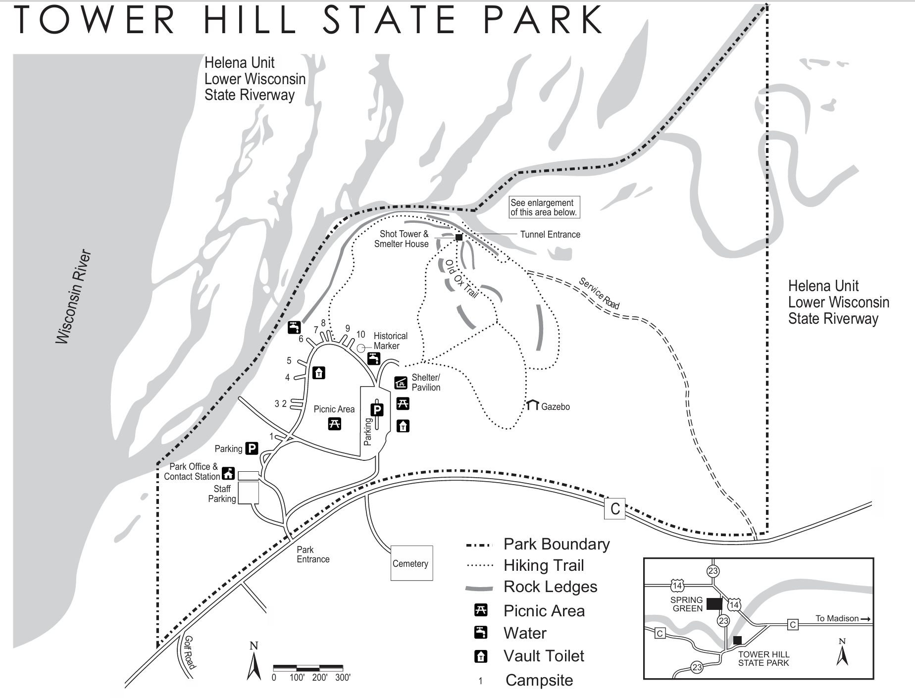

Once the drop off vehicles are back, we will start our Journey. On Saturday we will paddle 10-15 Miles. Wooded bluffs with beautiful limestone and sandstone outcroppings lie along the south side of this downstream excursion; some even rise right out of the river. The plan is to get to Muscoda by Sunaday Night/Monday Morning. The following maps came from this site.
Muscoda Boat Landing: E Water St, Muscoda, WI 53573-9153


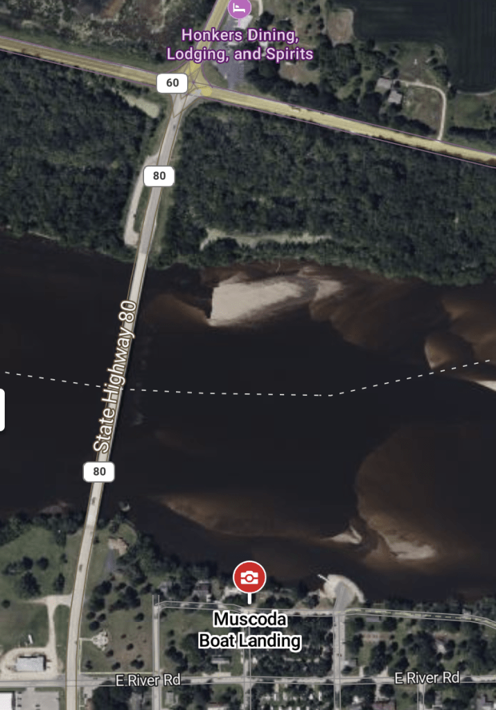
Victoria Riverside Park Landing at Muscoda
River: The landing is on a tiny, rocky peninsula that extends out from the left bank as you approach the Highway 80 Bridge. You will see a covered pavilion
near the access. Riverside Park and the town of Muscoda are behind the landing.
The park is owned and maintained by the town of Muscoda and offers shaded picnic areas and camping. Trailer ramp, trailer turnaround, parking area, restrooms, water.
Muscoda is pronounced ‘muh – skoh – day’, not ‘muh – skoh – dah’.
MONDAY:
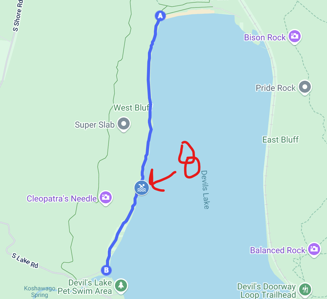
Was thinking we could hit Devils Lake State park for some cliff jumping and rock climbing on Monday on the way home! Meet at the north shore then hike the West Bluff Trail south to the Dead Tree Wall Rock Climbing area. 43°25’17.4″N 89°44’18.3″W Here is a pin.

Nice Steep 50 to 60 Ft. wall with good routes to be found just to the north of Reclining Tower area as one walks north along the West Bluff Trail. The top of Dead Tree Wall is very close to to the trail. There is a prominent central crack line called….you guessed it… “Dead Tree Crack”.Easy 3rd class gully just south of the wall. Don’t go directly down the section of the gully that lies closets to the West Bluff Trail but ease down a tad bit further from the trail. You will find it easier. Just follow the slope down along the ever growing wall to the base after negotiating the gully.


If we aren’t there, we are at ROCK 8 for swimming 2/3 of the way from the trailhead south on Tumbled Rocks Trail. Just under a half-mile south of the north shore beach on Devil’s Lake State Park’s Tumbled Rocks trail, you’ll come upon the park’s popular diving rock, “Rock 8”. Rock 8, which looks a bit like the front end of a whale from the water, can provide a diving platform ranging from 4-12 feet above the water depending on the lake level.
Why is it called Rock 8?
At one time a surveyor camp from the University of Wisconsin was located on the south-west corner of Devil’s Lake. At that time a variety of locations around the lake were numbered for training purposes. Rock 8, as you have probably guessed, had a big “8” painted on it.